

Hong Kong may face stormy conditions over the Mid-Autumn Festival weekend, as a developing tropical cyclone is currently forming east of the Philippines and is expected to enter the South China Sea later this week. The Hong Kong Observatory has warned that unsettled weather is likely.
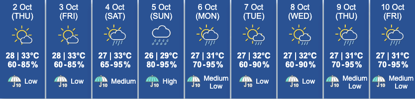
Weather conditions on the day of the Mid-Autumn Festival (October 6), are forecast to be cloudy with scattered showers, which may affect outdoor moon-watching plans.
The system, expected to be named Matmo, formed east of the Philippines and is forecast to move into the South China Sea by Friday. As of Wednesday afternoon, the system was a tropical depression located around 1,950 kilometres east-southeast of the city, with sustained winds of 45 km/h. Forecasts suggest it may reach 145 km/h by Saturday and intensify further to 175 km/h as it nears the coast of western Guangdong by Sunday.
Offshore and high-ground winds in Hong Kong are expected to reach Force 6 or 7 over the weekend. This corresponds to gusts between 40 and 62 km/h, possibly triggering a Strong Wind Signal No. 3.
AI models like Fengwu also indicate the storm could pass close to Hong Kong on October 4 to 5, while other forecasting models suggest the storm will intensify significantly. The cyclone’s exact path and strength remain uncertain.
If Matmo triggers a warning signal, it would mark the 12th tropical cyclone to affect Hong Kong this year, breaking a post-war record set in 1946. Just last week, Super Typhoon Ragasa passed 120 kilometres south of the city, triggering the No. 10 signal and injuring over 100 people.
Earlier in September, Severe Tropical Storms Tapah and Mitag also brought thunderstorms and triggered typhoon signals, making this one of Hong Kong’s most active storm seasons in recent years.
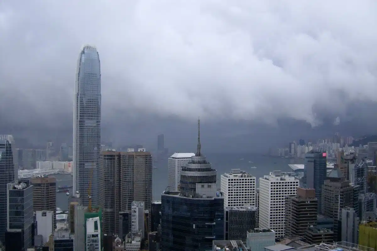
Image credits: sirwelander via Canva