

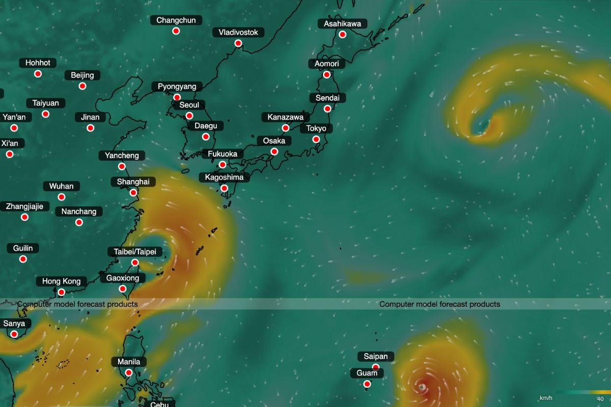

Hong Kong is heading into a stormy stretch as forecasters monitor two areas of low pressure developing around the South China Sea and waters east of Luzon.
While neither system is currently forecast to make a direct hit on the city, several weather models point to heightened tropical cyclone activity nearby, alongside days of showers, thunderstorms and stronger winds ahead.
Two Tropical Cyclones Could Develop Within 10 Days
China’s National Meteorological Centre expects tropical activity to remain elevated over the next 10 days, with two tropical cyclones potentially forming across the northwest Pacific and South China Sea. It forecasts cumulative rainfall of around 100 to 250 millimetres between August 16 and 25 across coastal southern China, Taiwan and Hong Kong.
AI weather models show a more active scenario. Fengwu suggests two potential cyclones could be within 800 kilometres of Hong Kong at the same time between August 19 and 23. The European Centre for Medium-Range Weather Forecasts’ (ECMWF) AIFS model and China’s Fuxi model have also indicated two systems near southeastern China around the same period. These outputs remain experimental and can shift considerably between runs rather than serving as official cyclone weather forecasts.
Hong Kong Observatory Forecasts Showers And Stronger Winds
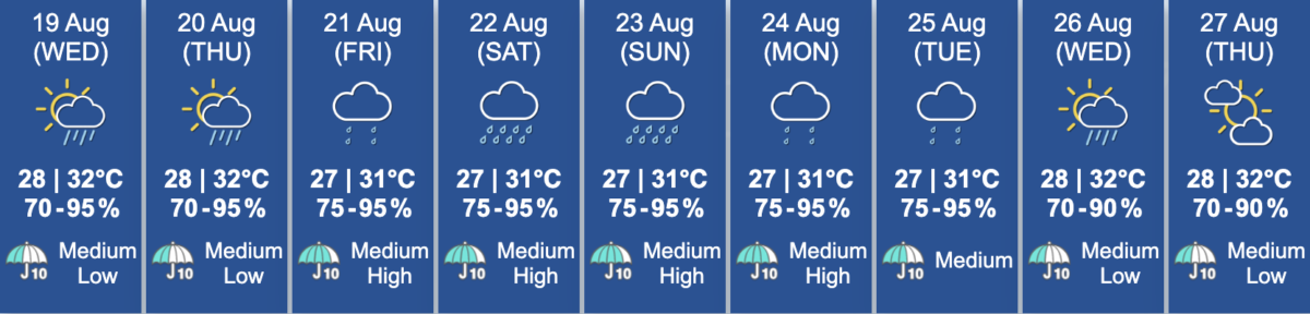
The Hong Kong Observatory says a broad trough of low pressure will affect the northern South China Sea and waters east of Luzon over the next few days, with two low-pressure areas embedded along it. Their development and tracks remain uncertain.
Hong Kong is forecast to see showers and squally thunderstorms, while winds may reach force 6 offshore and on high ground. Conditions are expected to stay unsettled into the weekend as the low-pressure system edges closer to southern China.
Image credits: AI weather model Fengwu