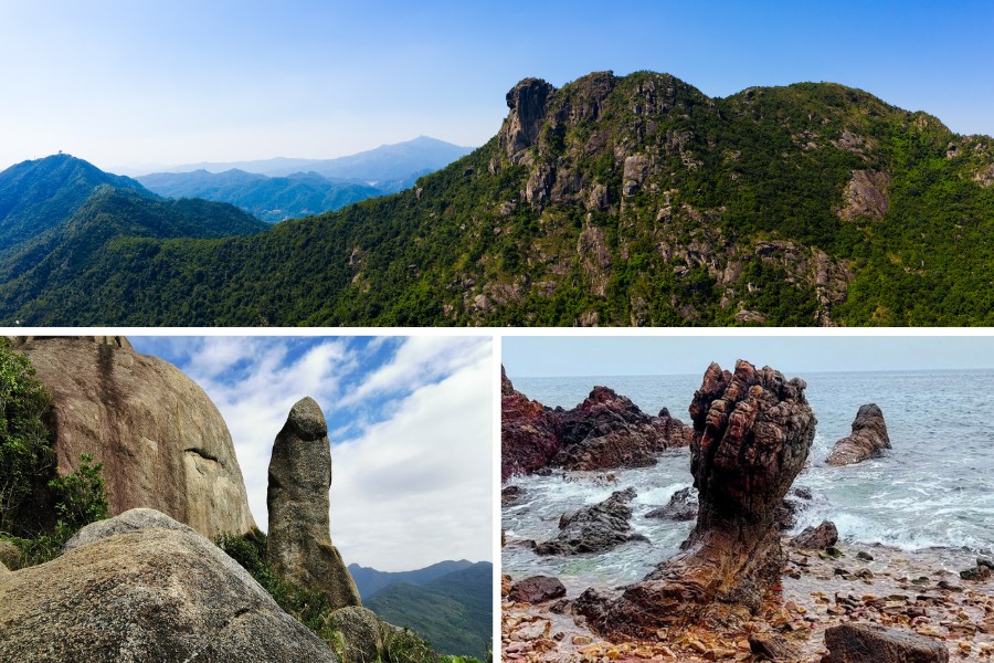
As the autumn breeze sweeps in, it’s time to lace up your hiking boots and immerse yourself in the natural beauty of Hong Kong. If you’ve grown tired of the popular trails and seeking for something different, you’ve come to the right spot. Hong Kong, known primarily as a concrete jungle, has a world-class geological landscape, giving rise to unusual, one-of-a-kind rock formations that can stir your imagination. Whether you’re a beginner or an experienced hiker, read along to discover where to explore this season.
Angel Wing Rock – Cheung Chau
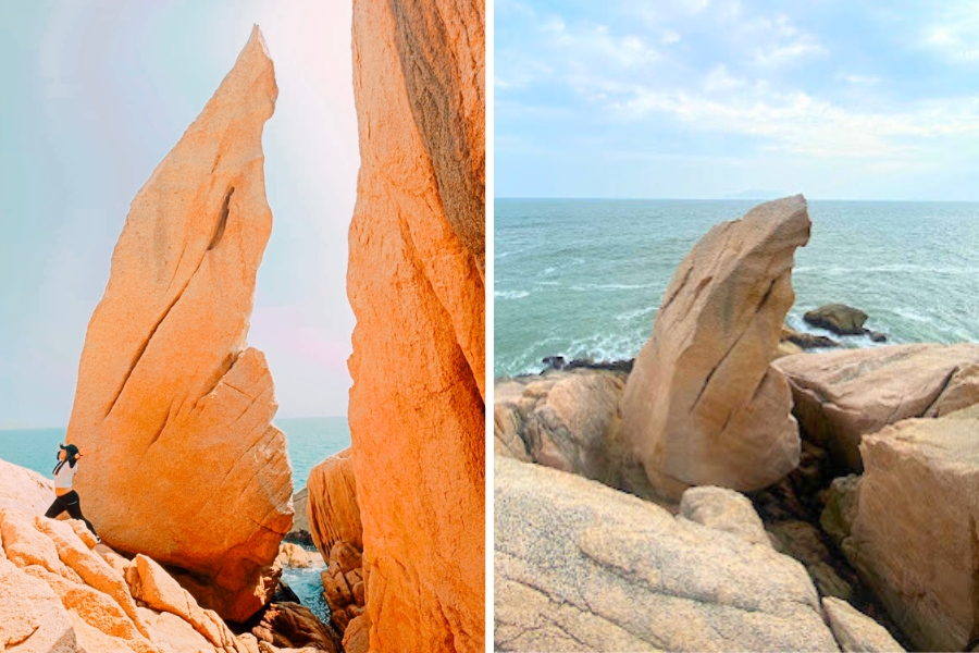
Take a leisurely one-hour hike round trip to Angel Wing Rock in Cheung Chau. Ideal for a day of exploration, this hidden gem set against the coastal views. From Central, take the ferry to Cheung Chau Pier, which takes approximately one hour. From there, follow the path to Tai Shek Hau Temple and continue to Tin Fook Pavilion. As you descend to the coastline, you’ll find the Angel Wing Rock. Afterward, treat yourself to local delights like mango mochi and giant Chiu-chow style fishballs.
Devil’s Fist – Wong Chuk Kok Tsui
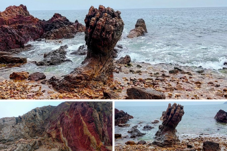
Hiking to Devil’s Fist in Wong Chuk Kok Tsui is no walk in the park; it’s one of Hong Kong’s most challenging treks, spanning 11 to 12 hours and covering nearly 30km. The rocks in this area, including one resembling Thanos’ hand, are some of Hong Kong’s oldest, dating back over 400 million years. Starting from Wu Kau Tang, the trail follows a portion of the Plover Cove Reservoir Country Trail before veering towards Wong Chuk Kok Tsui from Luk Wu Tung. Alternatively, take a speedboat from Wong Shek Ferry and drop off at Wong Chuk Kok Tsui for convenience.
Duration: 12 hours
Getting there: Take minibus number 20K from Tai Po Market East Rail Station to Wu Kau Tang
Fat Pig Rock – Lantau Island
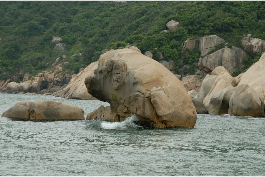
Fat Pig Rock, nestled in the southern part of Lantau Island, is a renowned natural wonder. Resembling a plump pig poised to take a dip in the deep blue sea, it stands proudly and even appears somewhat arrogant when viewed from the opposite side. Located near the Sesame Bay Peninsula, this distinctive rock formation is a must-see for nature enthusiasts and curious hikers.
Fat Pig Rock, situated on the Sesame Bay Peninsula, is a well-known rock on Lantau Island’s southern shores. Resembling a plump pig lifting its hind leg as if preparing to enter the sea, sparks curiosity and imagination. Whether you see it as cautious or proud, the rock is a must-see for nature enthusiasts.
Duration: 20-30 minutes on kaito ferry
Getting there: Take a kaito ferry from Cheung Chau to Ha Keng Pier, Chi Ma Wan. The Fat Pig Rock can be observed up close from your ride.
Lion Rock – Wong Tai Sin
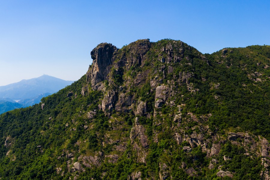
The iconic Lion Rock is one of the most renowned hiking trails in Hong Kong. The hike takes you to a lion-head-shaped rock at the summit, a perfect spot for sunset. Celebrated for its panoramic city views, this hike begins with a challenging ascent of steps in the forest. Along the way, enjoy glimpses of the city. When you reach the top, you will find Kowloon Peninsula and Hong Kong island on one side, while Sha Tin on the other side. Prepare a pair of gloves to go up to the rock.
Duration: 3 hours
Getting there: Take a taxi or walk 20 minutes from Wong Tai Sin MTR Station to Fat Jong Temple, then proceed to the Lion Rock archway entrance gate
Mask Rock – Wong Ngai Chung
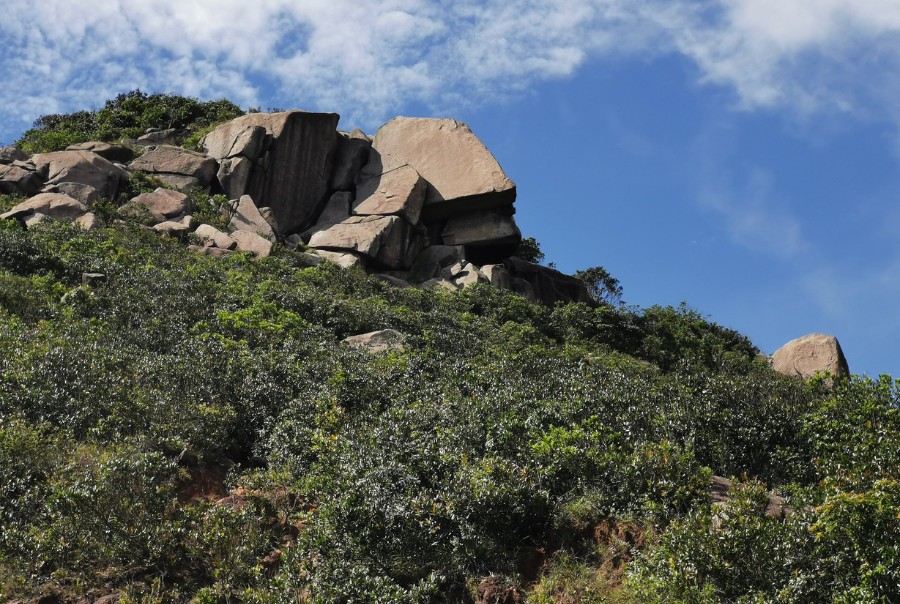
Mask Rock, perched halfway up Mount Nicholson in Wong Ngai Chung, allow you to discover the beauty of southern Hong Kong, from the crystalline waters and the lush Tai Tam Country Park. The two-hour journey starts at Wong Nai Chung Reservoir Park. Ascend via Black’s Link of Hong Kong Trail Section 4, and walk through rocky terrain to the Mask Rock, which has distinct left and right profiles, reminiscent of Easter Island’s Moai statues.
Duration: 1.5 hours
Getting there: Take bus number 5, 6, 41A, 63, 66, and 76 to the Wong Nai Chung Reservoir Park bus stop
Palms Cliff – Po Toi Island
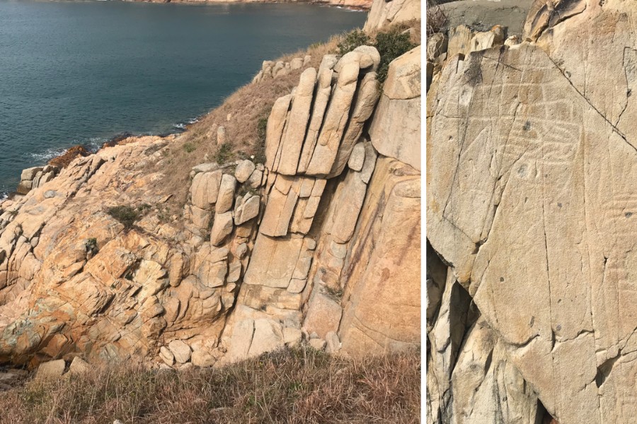
Po Toi Island, located in Hong Kong’s southernmost tip, is a peaceful escape away from the city’s hustle and bustle. Take a leisure walk on this 3.69-sq-km island to find strange rock formations like Conch Rock, Monk Rock and Tortoise Rock, alongside ancient Bronze Age rock carvings, and stunning landscapes. Once you reached Nam Kok Tsui Lighthouse on the south, you will find Palm Cliff, also known as Buddha’s Hand Rock. This cliffside, from a certain angle, looks like a person is praying or meditating. Remember to bring your own snacks and drinks, as amenities can be limited.
Duration: Spare one full day on Po Toi Island, as transportation is limited
Getting there: On Tuesdays and Thursdays, kaito to Po Toi island departs once a day at 10am from Po Toi Ferry Terminal in Aberdeen. On weekends and on public holidays, ferries runs from Aberdeen. Check the government website for ferry schedules.
Penis Rock – Sha Tin
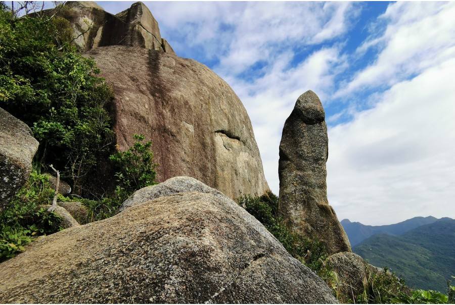
Nestled within Ma On Shan National Park, you’ll find the quirky Penis Rock, once crowned “The World’s Best Looking Penis Shaped Rock”. Situated among several other famed rock formations, this unique phallic rock sits near the summit of Nui Po Shan. While multiple trails lead to reach it, the quickest and easiest path begins in Mui Tsz Lam village, taking about 45 minutes. Expect a gentle ascent followed by a steeper section with ropes for assistance. Sturdy hiking shoes are a must.
Duration: 3 hours
Getting there: Take a cab to Mui Tsz Lam village
Pineapple Hill – Tuen Mun
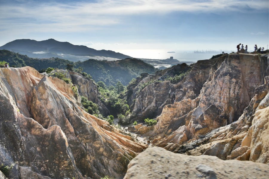
Looking for a canyon similar to Arizona’s iconic landscapes? Pineapple Hill, also known as the Great Canyons of Hong Kong, offers just that. Its name comes from its resemblance to the crust of a pineapple bun, a local breakfast favourite. This less-traveled trail in Tuen Mun provides panoramic views of the New Territories and Shenzhen. Plan for an afternoon hike and end with a stunning sunset in Ha Pak Nai Village. Make sure to check the government website beforehand since some parts of the route pass near the Tsing Shan Firing Range, which is occasionally used for military exercises.
Duration: 2 hours
Getting there: Take Light Rail 505 from Siu Hong MTR Station to Leung King Light Rail Station
Po Pin Chau – Sai Kung
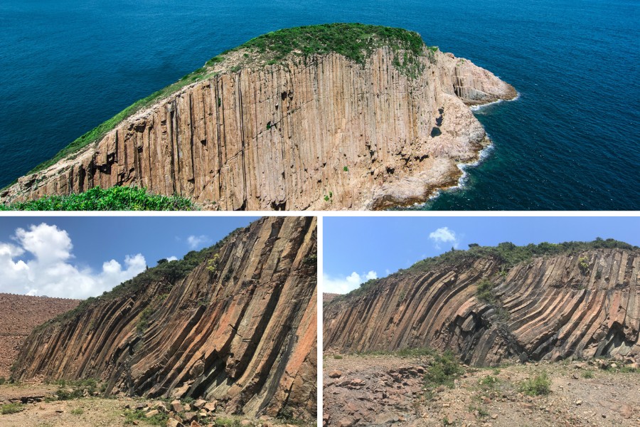
Po Pin Chau, situated off Sai Kung East Country Park’s southeastern coast, is an extraordinary geological formation within the Hong Kong UNESCO Global Geopark. As a result of volcanic eruptions 140 million years ago, this small island is renowned for its hexagonal rock columns.
The hike to Po Pin Chau is rewarding and not overly challenging. Start at the High Island Reservoir Monument on the East Dam within Sai Kung East Country Park. Follow an unmarked trail that winds through hills and valleys along the coast, taking in the hexagonal rock columns along Po Pin Chau’s shores and the Kim Chu Wan and Tsat Chung Beaches.
Duration: 4 hours
Getting there: Take taxi from Sai Kung to High Island Reservoir Monument
Rhino Rock – Stanley
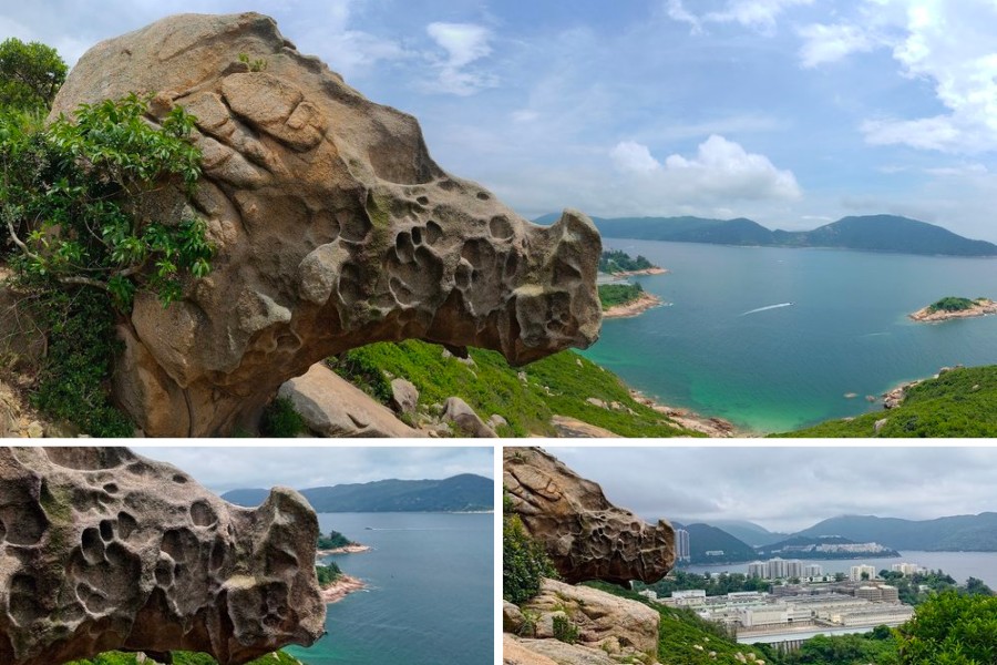
If you’re new to hiking in Hong Kong, Rhino Rock in Stanley is a perfect introduction. This short and accessible trail takes just around 1.5 hours to complete. The highlight is undoubtedly the stunning Rhino Rock itself, set against an ocean backdrop – a perfect photo opportunity. Wear suitable hiking shoes as parts of the trail are sandy. After your hike, treat yourself to a visit to Stanley Beach and maybe some refreshing cocktails!
Duration: 1.5 hours
Getting there: Take bus number 14 from Sai Wan Ho MTR station to Stanley Fort bus stop
Springboard Rock – Sunset Peak
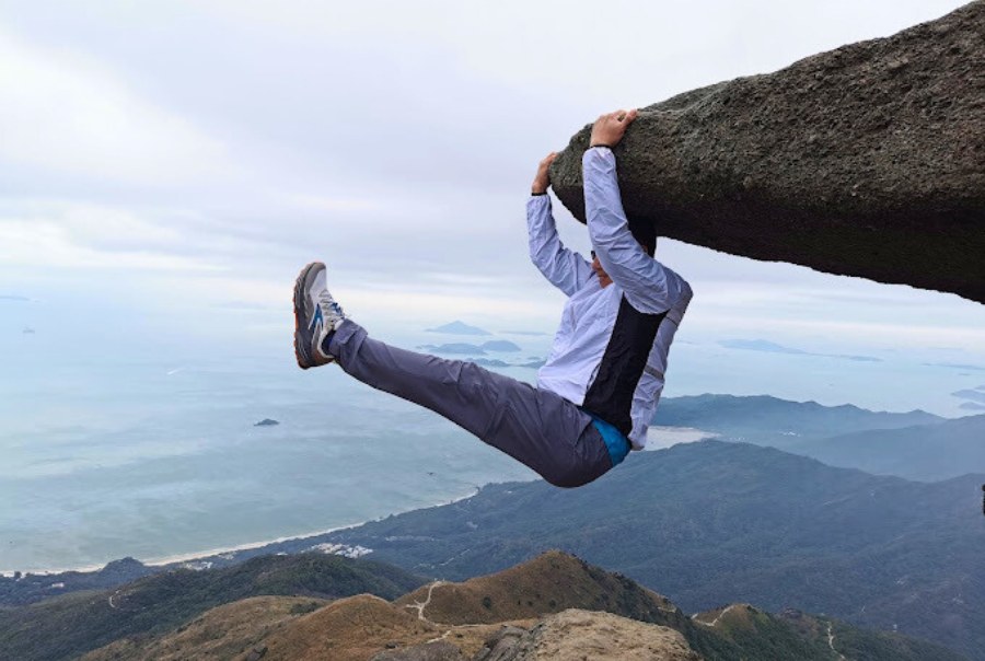
Nestled on Sunset Peak, Hong Kong’s third-highest mountain on Lantau Island, lies the famous Instagram hot spot – Springboard Rock. Begin your hike at Pak Kung Au, and after a 2 km uphill climb along the Lantau Trail, you’ll encounter this iconic photo spot, near signpost L015. The view from Springboard Rock is worth the trek, offering panoramic vistas of bays, beaches, and the seasonal silvergrass. Bring a headlight and a hiking pole if you plan to stay for the sunset.
Duration: 6 hours
Getting there: Take bus number 3M from Tung Chung MTR station to Pak Kung Au
Stone Window – West Buffalo Hill
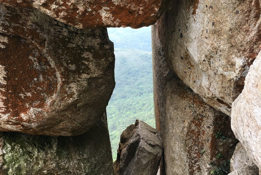
West Buffalo Hill in Ma On Shan Country Park is known for its intriguing rock formations, including the famous Stone Window. Begin your hike from Sha Tin’s Siu Lek Yuen, this roughly 3.9-kilometer trek takes around two hours one way, so plan for a four-hour round trip. The Stone Window is a popular spot, so expect some waiting time for photos. Be prepared for stairs and slippery sections, making proper hiking gear essential for an enjoyable journey.
Duration: 4 hours
Getting there: Take bus number 83K from Sha Tin Central Bus Terminus to Wong Nai Tau Bus Terminus
Tung Ping Chau
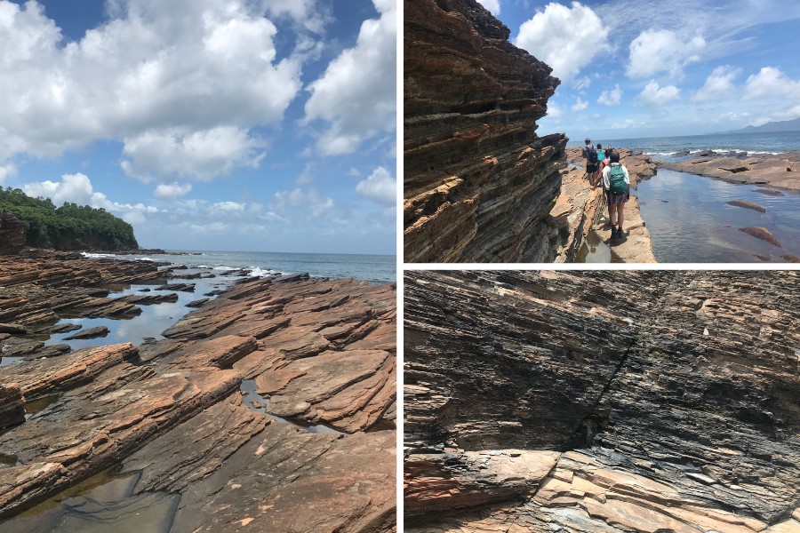
Take a ferry ride to Tung Ping Chau, Hong Kong’s easternmost island and a part of the Hong Kong UNESCO Global Geopark. Here, the relentless sea and time have shaped rocks into surreal forms and intricate patterns. Starting from A Ma Wan, where the rocks are fine laminated sedimentary rocks, proceed to Kang Lau Shek, also known as the “museum of geomorphology”, laid out in tilted, flat rocks that took a century to form, resembling giant buried books. The layered texture, to the touch, feels like stacked pages of ancient tomes. Continue exploring Lung Lok Shui, Cham Keng Chau, and Cheung Sha Wan, where you can find more unique rock formations. Conclude your day with a satisfying meal of Chinese dishes and seafood specialties in Tai Tong village.
Duration: Spare one full day on Tung Ping Chau, as transportation is limited
Getting there: To get to Tung Ping Chau, take the ferry from Ma Liu Shui Public Pier. Ferries operate only on Saturdays, Sundays and public holidays.
Header image credit: Leung Cho Pan via Canva, rogbiv ng via Flickr, Kamal Mirwani via Hong Kong Hike


