

The Hong Kong Observatory has forecast unsettled weather over the city for the coming week, with squally thunderstorms and daily showers predicted over the territory until early next week. The meteorological body attributes this to “a trough of low pressure”, which will move away from the coast of Guangdong by the middle of this week. However, the SAR will experience persistent cloudy weather and rain over the weekend due to an upper-air disturbance.
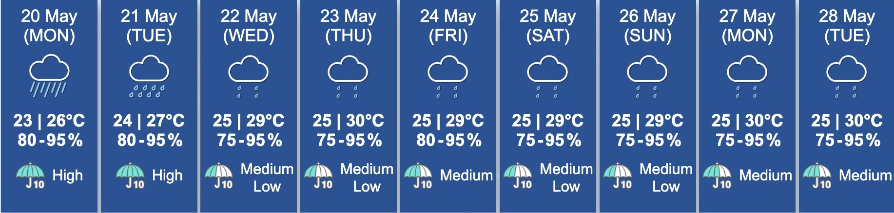
Hong Kong closed out the weekend with a thunderstorm warning that was issued at 6:40pm on Sunday and lasted until 2:50am on Monday morning. The rain is forecast to be heaviest on Monday and Tuesday, and will ease off for a couple of days mid-week. The weekend will be preceded by isolated thunderstorms on Friday. Throughout the week, humidity levels will hover between 75% and 95%, and temperatures will range from 23-30 degrees Celsius.
So far this month, the observatory has issued four rainstorm warnings — three amber rainstorm warnings with rainfall exceeding 30mm in an hour, and the first red rainstorm warning of the year, when rainfall exceeded 50mm in an hour. However, the city will likely get the most rain this year between June and October, when 5-8 tropical cyclones are forecast to hit Hong Kong.
To stay up-to-date with the weather in the city, visit the Hong Kong Observatory website.
Header image credits: johnlsl via Flickr