Update : For the latest updates, please read this article.
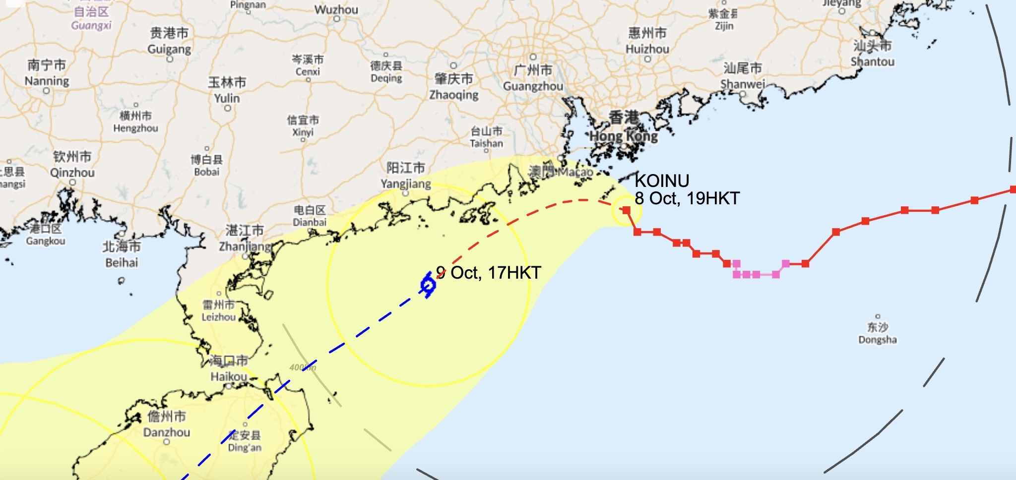
The Hong Kong Observatory issued the Increasing Gale or Storm Signal, No. 9 at 7.05pm on Sunday as Typhoon Koinu edges closers to to the city than previous forecasts indicated. The weather system, which is currently a Typhoon, will come maintain a distance of 60-70km from the SAR on Sunday night.
Typhoon Koinu Approaches Hong Kong
According to current predictions, Koinu will maintain its Typhoon status throughout Sunday and weaken to Severe Tropical Storm intensity by Monday. The observatory forecasts “heavy showers over the territory today (Sunday) and tomorrow (Monday)”.

Earlier, it was thought that Koinu would edge past Hong Kong and stay 150km south of the city. The observatory hoisted the Strong Wind Signal, No. 3 on Friday evening, causing several outdoor events such as the Waterfront Carnival and night markets across the city to close. However, the meteorological body later upgraded the warning to the No. 8 Gale or Storm Signal on Sunday afternoon.
Impact and Precautions in the City
All ferry services across the territory are suspended, the MTR will run limited trains, and its bus operations have been halted. All morning school classes on Monday will be cancelled, in accordance with Education Bureau regulations, if the warning is still in place by 5.30am tomorrow.
Latest Updates
T8 is now in place and the Observatory issue T3 at 11:40AM. For the latest news, please read this article.
The last time the Hong Kong Observatory issued the T9 signal in October was almost 48 years ago, when Super Typhoon Elsie, which was later upgraded to T10, hit the city on October 14, 1975. However, the territory has seen more rain than usual in 2023, as T8 was hoisted for Typhoon Talim in July, T10 was raised for Typhoon Saola in September, and the longest Black Rain warning in the city’s history was issued just a week later.
Header image credits: NASA via WikiCommons


