Update : For the latest updates, please read this article.
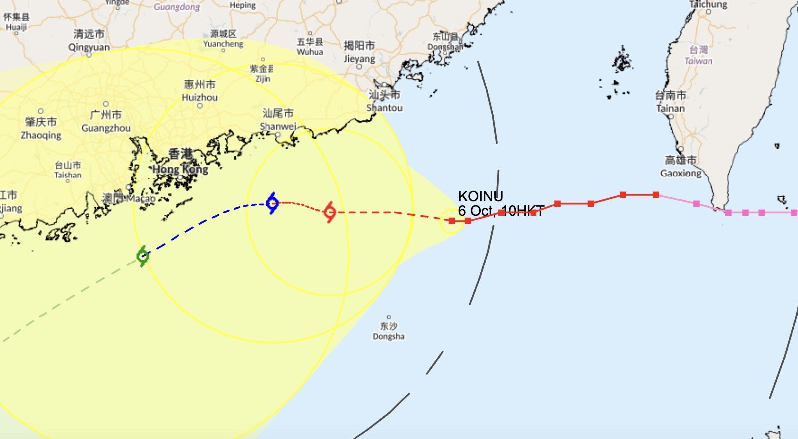
The Hong Kong Observatory will issue the Strong Wind Signal, No. 3 at 5.40pm on Friday, as according to current forecasts, Typhoon Koinu is within 400km of the SAR. The city’s meteorological body estimated that the weather system, which is currently at Typhoon status, was about 350km east of Hong Kong at 10am on Friday. The observatory issued the Standby Signal, No. 1 Wednesday night as Typhoon Koinu approached within 800km of the territory.

The system is expected to further weaken to a severe tropical storm on Sunday morning, when it will be closer to the SAR. According to observatory officials, “Koinu is expected to weaken slightly under the influence of the northeast monsoon when it edges closer to the vicinity of the Pearl River Estuary in the next couple of days. Showers will be heavy at times on Sunday and Monday.“
In the meantime, it will be dry with sunny periods during the day, and very hot on Friday afternoon. However, the observatory says it will get cooler on Sunday and Monday.
Hong Kong experienced two major typhoons over the summer. The first was Typhoon Talim in mid-July, for which Storm Signal No. 8 was raised. Typhoon Saola hit the SAR in early September, during which the Storm Signal 10 was hoisted for the first time in five years. During both typhoons, the MTR ran at reduced frequencies, and bus and ferry services were cancelled.
The territory also saw its highest rainfall in 140 years in early September, when the longest Black Rainstorm warning in the city’s history — lasting 16 hours and 35 minutes — was issued. Schools across the city closed, roads were waterlogged, and the Wong Tai Sin MTR station flooded.
To understand Hong Kong’s typhoon signals and weather warnings, read our explainer here. If you want to know how to best prepare for a typhoon in Hong Kong, read our guide here.
Header image credits: johnlsl via Flickr


